
CLICK HERE to read the USGS press release regarding West Virginia's new 3 meter elevation dataset!
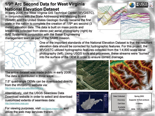
In conjunction with the West Virginia State Addressing and Mapping Board (SAMB) and the United States Geologic Survey (USGS) office in Rolla, MO, the West Virginia GIS Technical Center (WVGISTC) has converted SAMB elevation mass points and breaklines into a raster surface for inclusion into the National Elevation Dataset. The horizontal resolution and vertical accuracy of this statewide Digital Elevation Model (DEM) is 3 meters. The projected was completed in early 2006. GIS users can download the data from one of two sources. The data can be downloaded by 7.5 minute quadrangle extents from the WVGISTC's 3 Meter Elevation Data page. These are USGS DEM files projected to UTM Zone 17 North with elevation units in feet. One can also visit the USGS Seamless Data Download Site and download the data from the National Elevation Dataset.
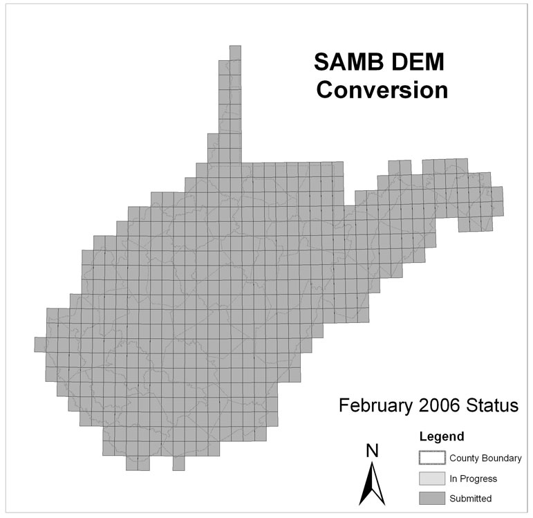
The SAMB contracted BAE SYSTEMS ADR to create a stereo photogrammetric-derived DTM from statewide spring 2003 aerial photography to support vertical elevation accuracies of +- 10 feet. The SAMB required its Project Management Team (Michael Baker Jr, Inc.) to perform independent quality assurance in order to certify final product acceptance. Baker used NSSDA automated and visual tests of attribute accuracy, logical consistency, completeness, and adherence to SAMB project data specifications. The WVGISTC, in conjunction with USGS, has developed a Triangular Irregular Network (TIN) methodology by which to convert the points and breaklines to a continuous terrain surface. The resultant local resolution data is included in the National Elevation Dataset at the 3-meter (1/9th arcsecond) product level.
This website contains a variety of archived technical resources and sample data that users may use and peruse. During production, this website served as a news portal. All information that was posted on this website is still here, for documentation purposes. Below, you will find links to three primary sections. The first section contains several documents that have been prepared by WVGISTC staff in relation to the project. A series of images and posters highlights the second section. Here you will find examples of several improved applications that the new 3-meter data will facilitate. Lastly, we have included some sample data available for download. The Lorado quad is located in southwest West Virginia and acted as the "guinea pig" for much of our early work on this project.
This section includes reports, assessments and procedures employed by WVGISTC throughout the process of creating the 3-meter elevation dataset. These documents are in .pdf format and you will need Adobe Acrobat Reader to view them. Download it here.
The thumbnails below lead to several images, each of which highlights details or applications of the new data. We have also included a link to a compressed file (.zip) that contains high resolution .jpgs of all of the images. The second section includes high resolution .jpgs of 36" x 48" posters that were created in order to showcase the data at a recent ESRI User's Group Meeting. These are available for download, individually compressed.
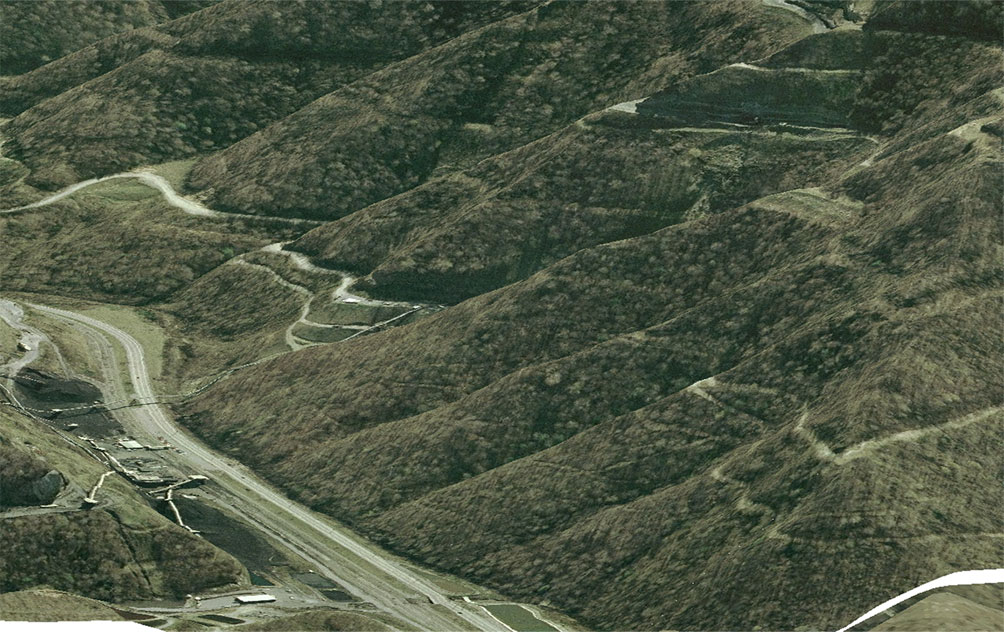
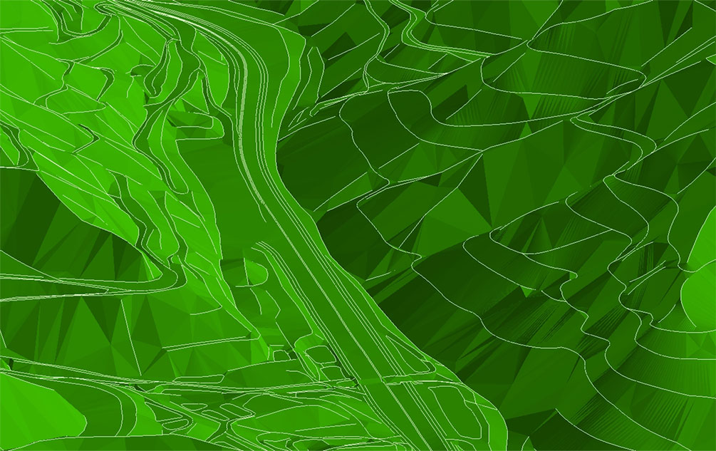
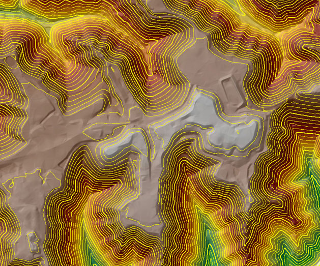
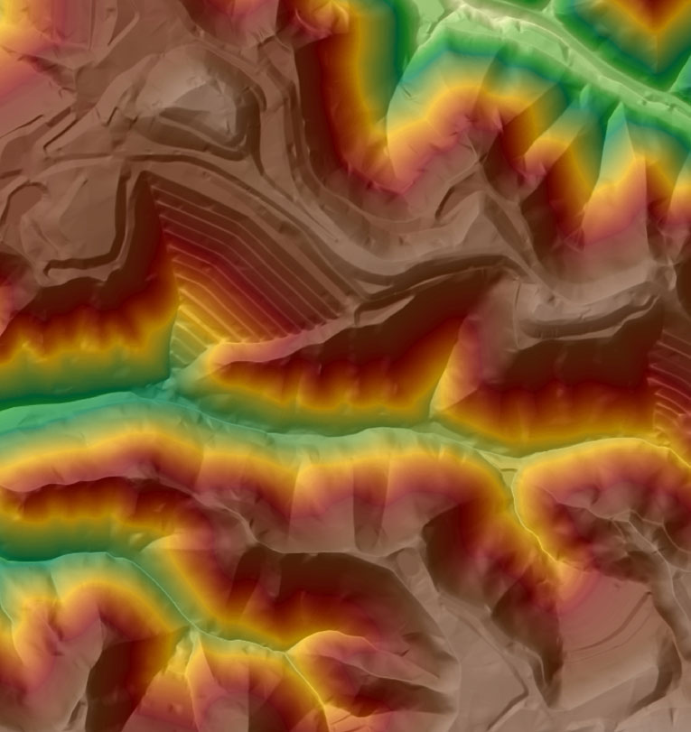
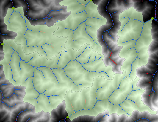
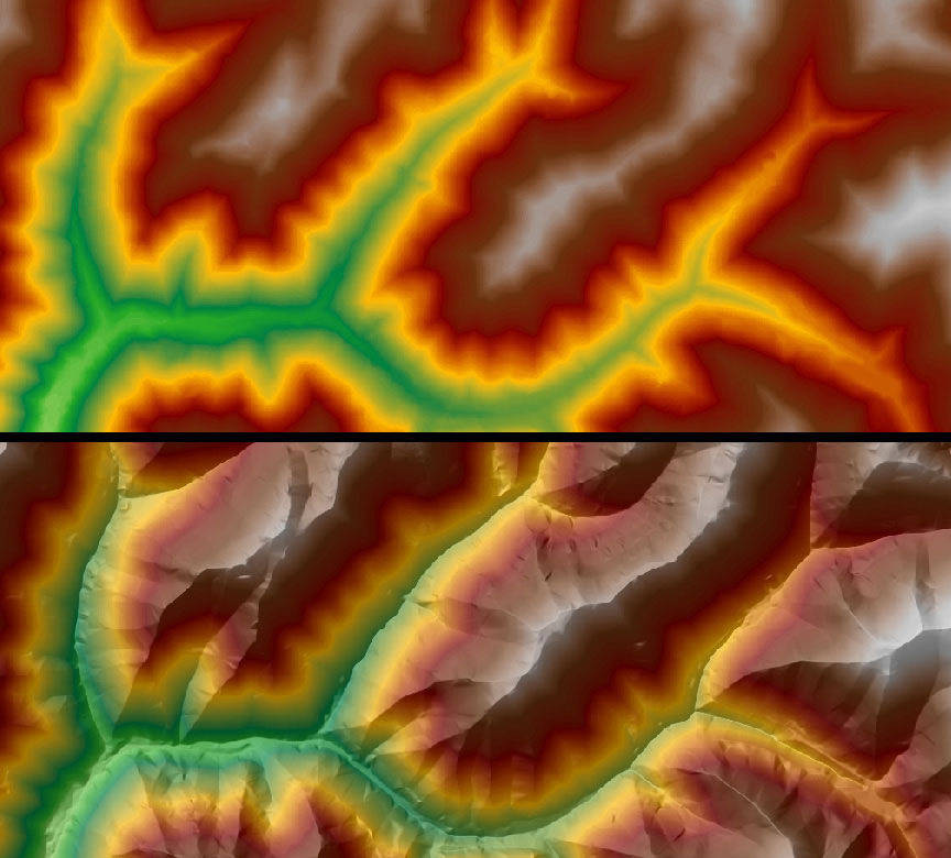
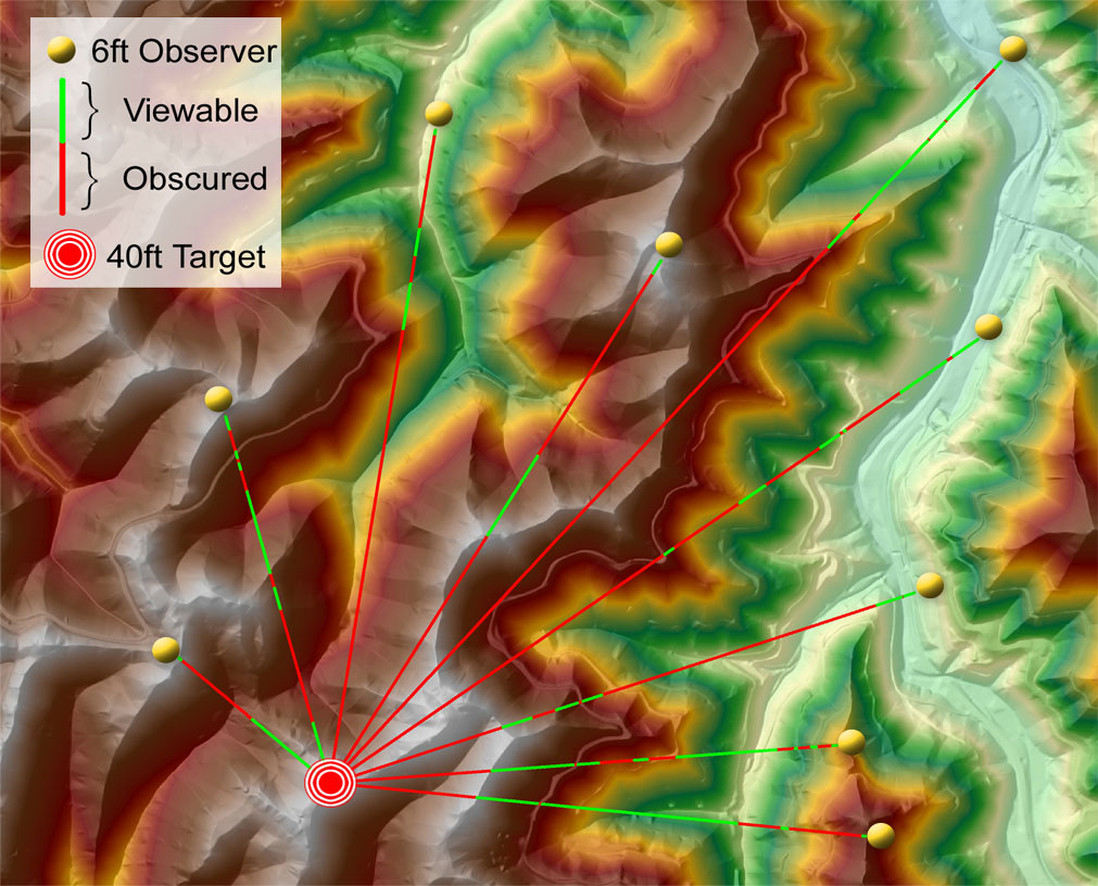
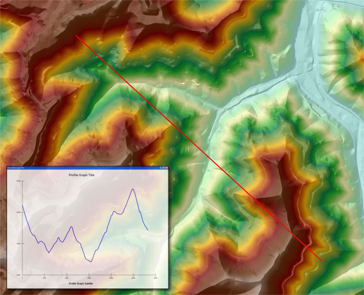
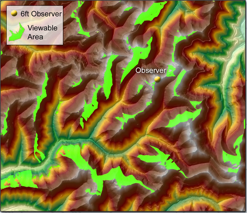
Image Downloads
All downloads are compressed as ZIP files.
Posters - We are providing two posters that were prepared for an ESRI User's Group meeting. One poster describes the process we are following to create the DTM surfaces, and the second poster discusses several application enhancements. These are both 36" x 48" .jpg files. Download the process poster here and the application enhancement poster here.
Sample Images - This ZIP file contains high resolution .jpgs of all the images above. Download here!
The link below will allow you to download new elevation data for the Lorado 7 1/2' quadrangle. This data is being provided in USGS DEM (.dem) format. The DEM has been projected to UTM, NAD 83, Zone 17. Vertical units are feet.